THE JOURNEY OF A HUNDRED MILES BEGINS
WE ARE ALPHARIAN
As a community of photography enthusiasts. There are Sony Alpha user representative from Cambodian, Malaysian & Indonesian etc.
 We all are ONE
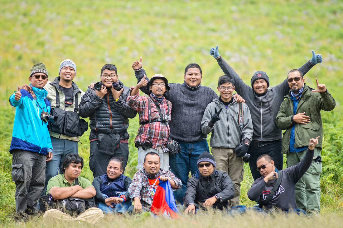
Before start the journey am with friends from Kuala Lumpur flew to Surabaya attended the 4th Annual Gathering Alpharian Photographer Community host by Sony Alpharian Surabaya East Java Indonesia. “ u guys rock! Thumb up!’
The event offers me the opportunity to meet colleagues from different countries and different religions and nationalities. it was fun to meet friends from the same hobby. I am hope is that this event could be instructive and inspiring event for all of us.
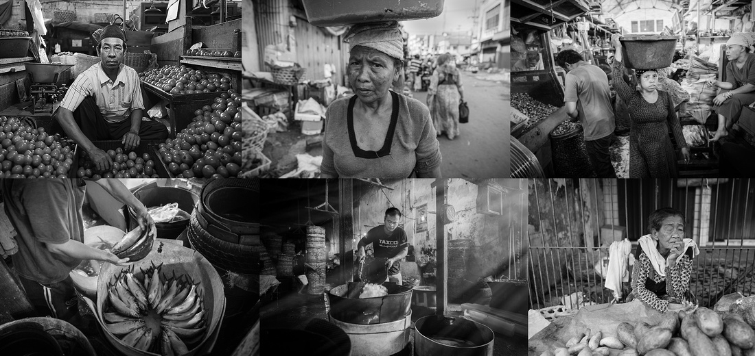
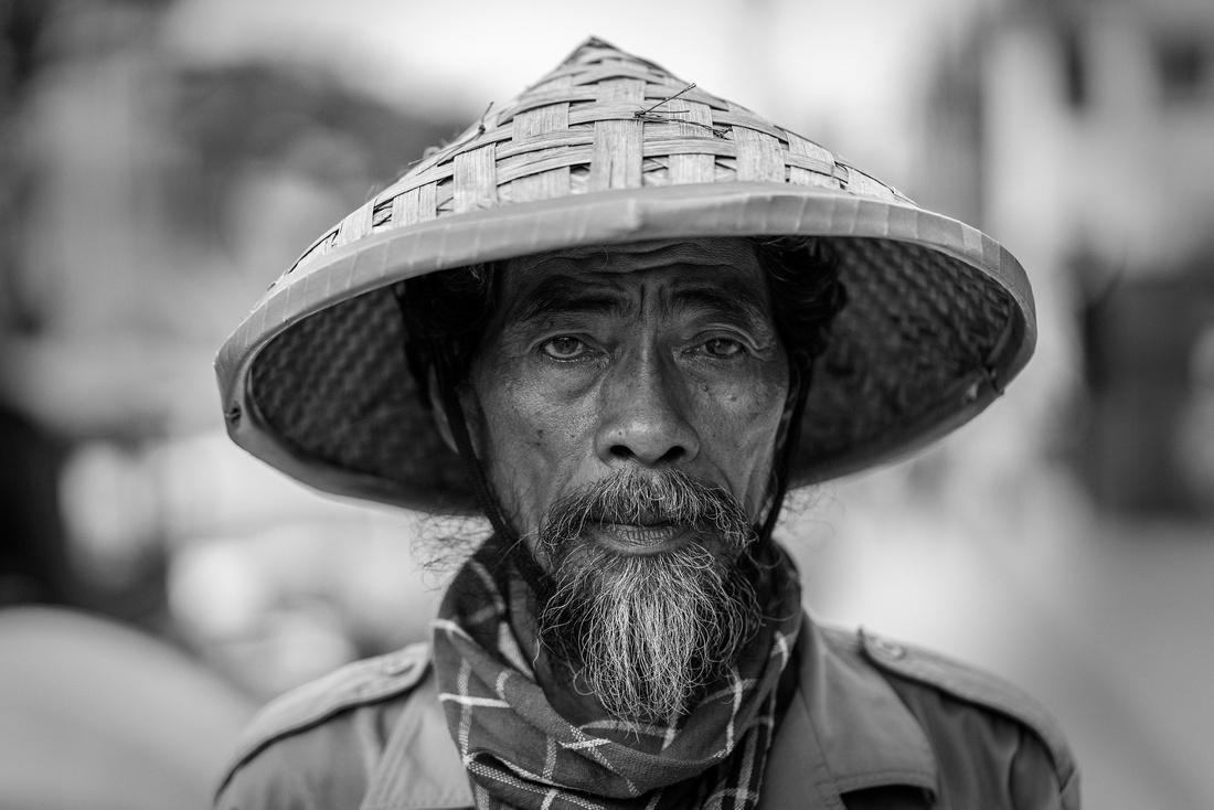
Photo Hunting during the event at Pabean Market oldtown Surabaya City
#
#
Photo Model at Bukit Jaddih Madura

Travelling in the wet season in East Java is not recommended by most guide books. Roads do get flooded, heavy traffic and travel plans may be have to be altered. somewhat dangerously it can be enjoyable and a great time to travel. And with weather patterns changing globally, you never know what to expect whatever season you travel in!. No worries am superb damn lucky have a lot of local friends some of them come from Bali, Manado, Banjarmasin, Jakarta, Surabaya and etc.
Thank you so much guys - Arik S. Mintorogo, Frunze, Laurensius Johan, Coco Yustian, Rizki Mahendra, Rusdi Sanad, Semmy Depri Absori, Qurnia Andayani, Deska Kusuma Wahyu Widodo, Antonius Widjaya, Ali Mahmudi, Riza Edwindra, Daniel Tjongari, Faizal ortho and others
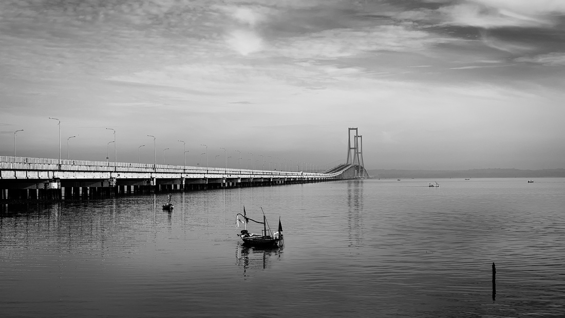
The islands of Madura, which is connected to Java by the longest bridge in Indonesia, Suramadu Bridge.
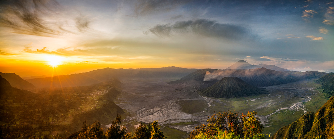
Panorama of Mt.Bromo
#
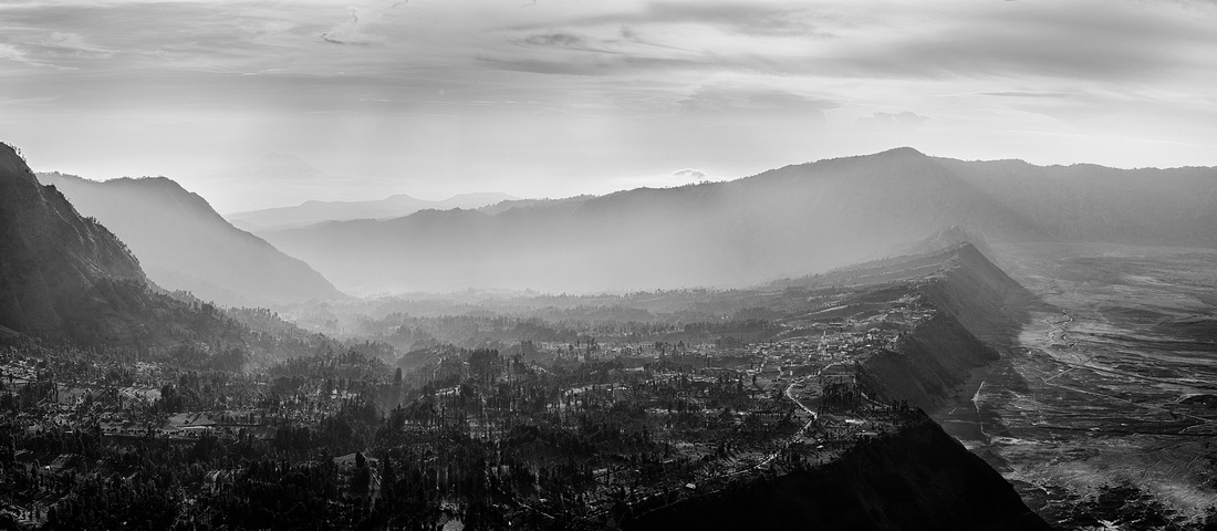
Mount Bromo is an active volcano and part of the Tengger massif, in East Java Indonesia. At 2,329 metres. The volcano belongs to the Bromo Tengger Semeru National Park. The name of Bromo derived from Javanese pronunciation of Brahma, the Hindu creator god. Here, at the top of King Kong Hill, lies a brilliant panoramic view of Mount Bromo, Mount Semeru, and the crater! 2nd time I was here not so lucky NO! mist/fog bcoz of raining season.
Panorama of Cemoro Lawang
#
The Breakfast

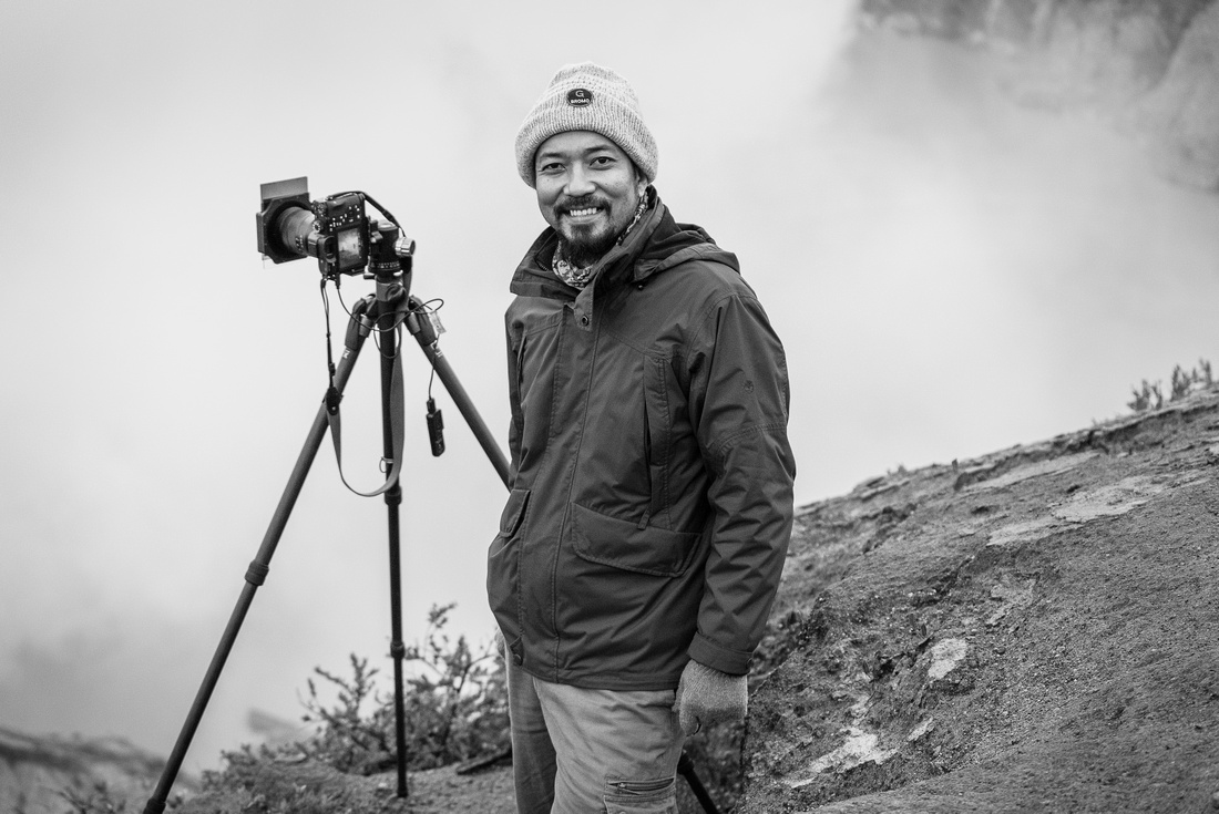
MYSELF
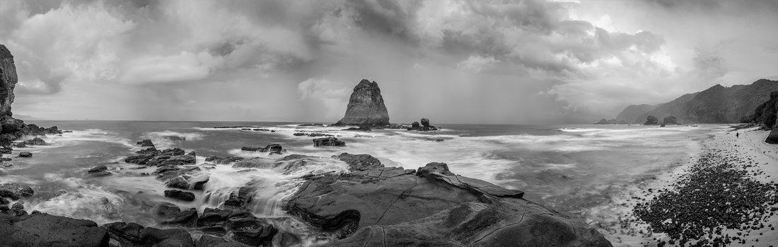
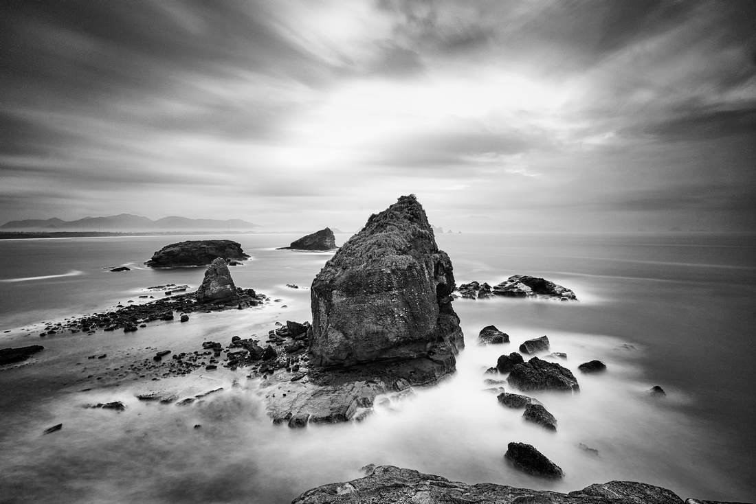
Panorama of Papuma Beach
#
Before the rain begins, one of the first odors you may notice as winds pick up and clouds roll in is a sweet, pungent zing in your nostrils.
Papuma beach is located 37 kilometers south of the town of Jember and are on track Bromo-Ijen-Bali. Beach with an area of 25 hectares of this, when viewed from above, looks like an elliptical arch. White sand beach complete the image resembles an egg.
#
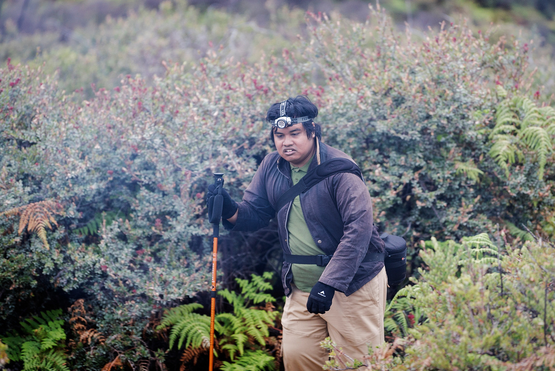
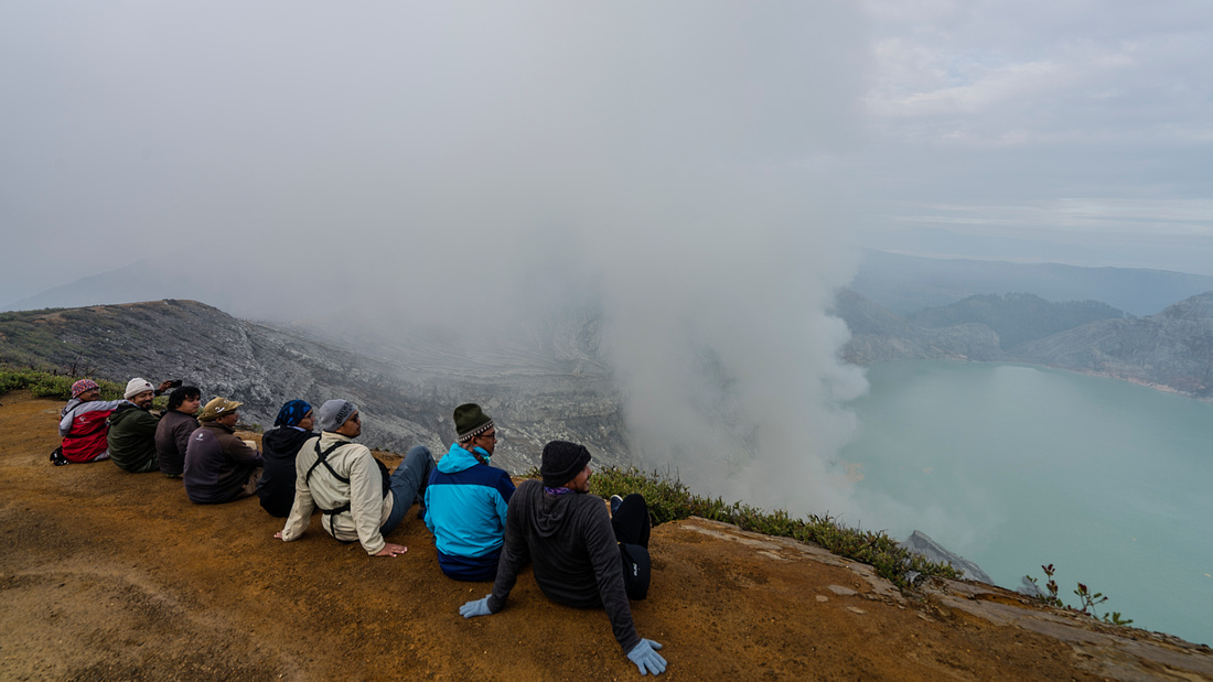
The Cloudy Day of Mt.Ijen
We`re 13 alpaharians completely and utterly unprepared for the adventure, which would turn out to be more challenging which its raining season —and more memorable—than anything we could have imagined. I take my hat off to Om Frunze has completed the course despite initially wanted to punt but Om Faizal Ortho encouraging him to continue the journey. At the top there eight of us had a very ‘memorable’ experience. Thumb Up guys!
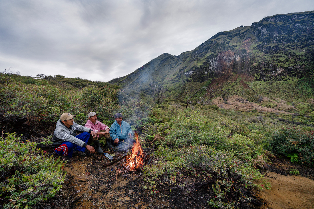
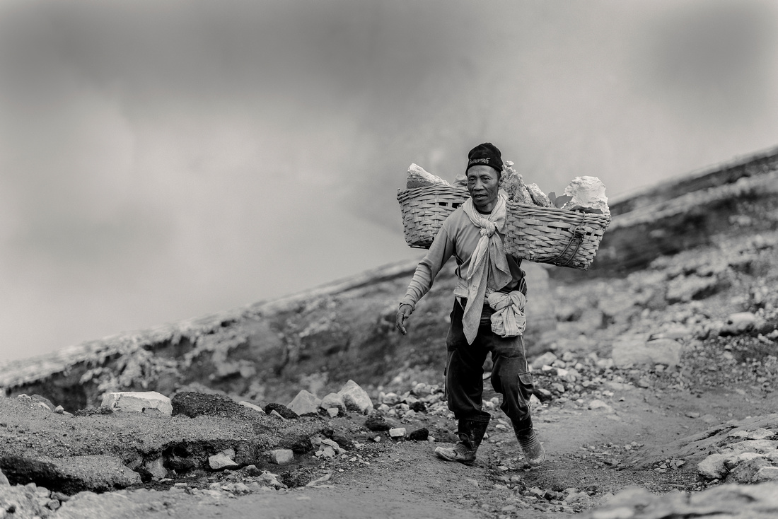
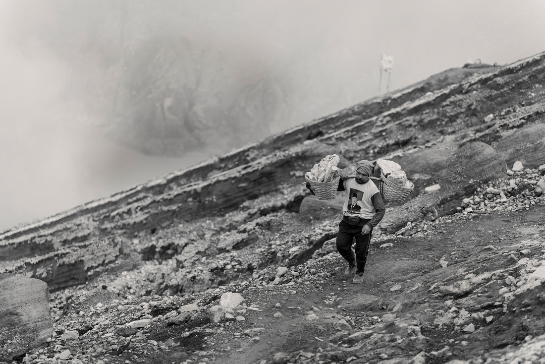
The Ghost Workingman's
Don't expect life to be fair
 Keep the privilege of a lifetime is being who you are
Were say life its not fair -- See yourself how they 'miners’ job. they must break off hot sulfurs and carry the backbreaking loads 100kg on their shoulders to a nearby refinery to get paid. --- Daily Life of Miners on foot hiking 4km up 4km down twice a day -- 2700 meter. They do it for around Rp200k a day, a decent local salary. -- THEY ARE AMAZING
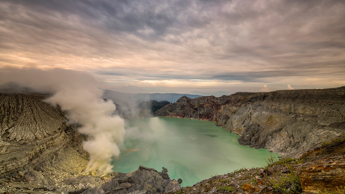
Info
Many other post-caldera cones and craters are located within the caldera or along its rim. The largest concentration of post-caldera cones run east-west across the southern side of the caldera. The active crater at Kawah Ijen has a diameter of 722 metres (2,369 ft) and a surface area of 0.41 square kilometres (0.16 sq mi). It is 200 metres (660 ft) deep and has a volume of 36 cubic hectometres (29,000 acre·ft).
The lake is recognised as the largest highly acidic crater lake in the world. It is also a source for the river Banyupahit, resulting in highly acidic and metal-enriched river water which has a significant detrimental effect on the downstream river ecosystem. On July 14-15, 2008, explorer George Kourounis took a small rubber boat out onto the acid lake to measure its acidity. The pH of the water in the lake's edges was measured to be 0.5 and in the middle of the lake 0.13 due to high sulfuric acid concentration.
The journey to be continued with broken english